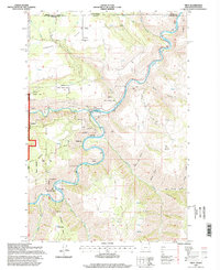
1995 Map of Troy
USGS Topo · Published 1998About this map
The confluence of the Grande Ronde River and the Wenaha River anchors this mid-1990s survey of the remote Oregon-Washington borderlands. This rugged canyon country is defined by steep elevation changes between high plateaus like Flat and Lightle Flat and the river basins below. The small settlement of Troy sits at the water's edge, serving as a focal point for the region's wilderness management and research activities. Evidence of specialized environmental study is visible at the U S Fish and Wildlife River Testing Station, complete with a nearby Fish Ladder and Gaging Sta. To the north, the upland community of Bartlett and the Bartlett Cemetery provide a connection to the area's pioneer genealogy. Much of the western terrain is dedicated to the Wenaha Wildlife Area and Umatilla National Forest, where features like Eden Ridge overlook the deep river cuts.
Find a feature on this map
41 named features on this map. Tap any name to fly to it.
Don’t see what you’re looking for? This feature index may not catch every label — zoom into the map to look around manually.
Map Details
Editions of this 1995 Troy Map
This is the sole edition of this map. No revisions or reprints were ever made.
Other maps of this area

1937 · Pomeroy
USGS Topo · 1:96,000

1942 · Pomeroy
USGS Topo · 1:125,000

1943 · Saddle Butte
USGS Topo · 1:62,500

1946 · Saddle Butte
USGS Topo · 1:62,500

1955 · Pullman
USGS Topo · 1:250,000

1955 · Grangeville
USGS Topo · 1:250,000

1958 · Pullman
USGS Topo · 1:250,000

1959 · Grangeville
USGS Topo · 1:250,000

1967 · Wood Butte
USGS Topo · 1:24,000

1967 · Troy
USGS Topo · 1:24,000