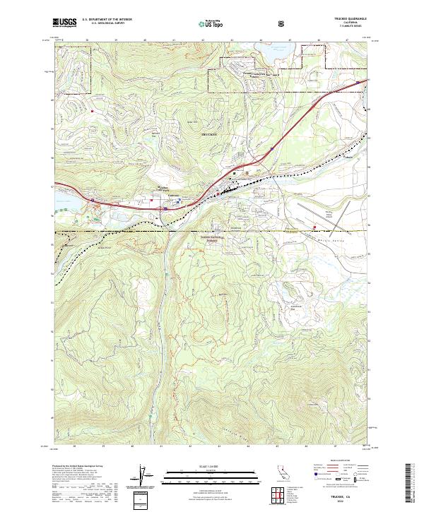
2022 Map of Truckee
USGS Topo · Published 2022About this map
Truckee River and Donner Creek converge in this high-altitude landscape, anchoring a mountain community where transportation corridors and recreational infrastructure define the terrain. The central settlement of Gateway sits near the Truckee Courthouse, while residential pockets like Prosser Lakeview Estates, Meadow Lake Park, and Ponderosa Palisades are spread throughout the timbered slopes of the Tahoe National Forest.
Find a feature on this map
48 named features on this map. Tap any name to fly to it.
Don’t see what you’re looking for? This feature index may not catch every label — zoom into the map to look around manually.
Map Details
Editions of this 2022 Truckee Map
This is the sole edition of this map. No revisions or reprints were ever made.
Other maps of this area

1891 · Truckee
USGS Topo · 1:125,000

1893 · Truckee
USGS Topo · 1:125,000

1895 · Truckee
USGS Topo · 1:125,000

1932 · Truckee
USGS Topo · 1:96,000

1940 · Truckee
USGS Topo · 1:125,000

1953 · Granite Chief
USGS Topo · 1:24,000

1953 · Granite Chief
USGS Topo · 1:62,500

1955 · Truckee
USGS Topo · 1:24,000
1955 · Kings Beach
USGS Topo · 1:24,000
1955 · Tahoe City
USGS Topo · 1:24,000