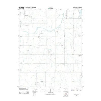
2012 Map of Tryon North
USGS Topo · Published 2012About this map
The Cimarron River meanders across the northern portion of this Oklahoma landscape, defining the local drainage patterns for numerous tributaries like Headquarters Cr and Dugout Cr. The area reflects a rural settlement pattern centered on the small communities of Cottingham and Agra. For genealogists and local historians, the sheet is particularly valuable for its documentation of burial sites, including the Iowa Indian Cem, Oakdale Cem, and Old George Cem. These sites, along with Parrott Cem and Osage Cem, serve as critical anchors for family history research in this part of Lincoln County. The landscape is also characterized by its extensive section-line road network, such as e0750 RD and n3400 RD, which still follow the original land survey boundaries. To the northeast, the presence of Cushing Lake provides a distinct hydrological feature in an area otherwise dominated by the river valley and its diverse creek systems like Brush Cr.
Find a feature on this map
58 named features on this map. Tap any name to fly to it.
Don’t see what you’re looking for? This feature index may not catch every label — zoom into the map to look around manually.
Map Details
Editions of this 2012 Tryon North Map
This is the sole edition of this map. No revisions or reprints were ever made.
Other maps of this area

1893 · Stillwater
USGS Topo · 1:62,500

1908 · Agra
USGS Topo · 1:62,500

1909 · Perkins
USGS Topo · 1:62,500

1929 · Ripley
USGS Topo · 1:62,500

1932 · Ripley
USGS Topo · 1:62,500

1954 · Oklahoma City
USGS Topo · 1:250,000

1955 · Enid
USGS Topo · 1:250,000

1957 · Oklahoma City
USGS Topo · 1:250,000

1958 · Enid
USGS Topo · 1:250,000

1963 · Oklahoma City
USGS Topo · 1:250,000