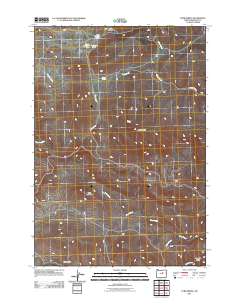
2011 Map of Tubb Spring
USGS Topo · Published 2011About this map
Tubb Spring and Tubb Creek anchor this central Oregon landscape, where the naming of remote water sources reveals the footprints of early homesteaders and ranchers. In this high-desert environment, individual springs like High Gilchrist Spring, George Iremonger Spring, and Iremonger Spring were critical assets for survival and livestock. The terrain is defined by prominent basaltic features such as Juniper Butte and Table Mountain, which rise above the drainages of Deep Creek and Fopiano Creek. To the south, Spanish Gulch and Spring Creek suggest a history of prospecting or specialized grazing in the varied topography of Wheeler County. The map provides a clear look at the network of valleys and hollows, including Smith Hollow and Pine Hollow, that shaped movement and land use across this territory.
Find a feature on this map
16 named features on this map. Tap any name to fly to it.
Don’t see what you’re looking for? This feature index may not catch every label — zoom into the map to look around manually.
Map Details
Editions of this 2011 Tubb Spring Map
This is the sole edition of this map. No revisions or reprints were ever made.
Other maps of this area

1932 · Dayville
USGS Topo · 1:125,000

1936 · Dayville
USGS Topo · 1:125,000

1953 · Richmond
USGS Topo · 1:62,500

1953 · Picture
USGS Topo · 1:62,500

1955 · Canyon City
USGS Topo · 1:250,000

1959 · Canyon City
USGS Topo · 1:250,000

1966 · Antone
USGS Topo · 1:24,000
1966 · Derr Meadows
USGS Topo · 1:24,000

1972 · Day Basin
USGS Topo · 1:24,000

1980 · Monument
USGS Topo · 1:100,000