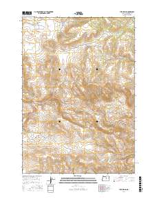
2017 Map of Tubb Spring
USGS Topo · Published 2017About this map
Waterman Flat and the surrounding Wheeler County uplands characterize this interior Oregon landscape, where water sources are vital landmarks for local history. Named springs such as Low Gilchrist Spring, High Gilchrist Spring, and George Iremonger Spring reflect the region's agricultural and homesteading heritage, providing essential points of reference in a terrain defined by ridges and drainages. The naming of George Iremonger Spring and Iremonger Spring suggests a legacy of specific family settlements in this high-desert environment.
Find a feature on this map
19 named features on this map. Tap any name to fly to it.
Don’t see what you’re looking for? This feature index may not catch every label — zoom into the map to look around manually.
Map Details
Editions of this 2017 Tubb Spring Map
This is the sole edition of this map. No revisions or reprints were ever made.
Other maps of this area

1932 · Dayville
USGS Topo · 1:125,000

1936 · Dayville
USGS Topo · 1:125,000

1953 · Richmond
USGS Topo · 1:62,500

1953 · Picture
USGS Topo · 1:62,500

1955 · Canyon City
USGS Topo · 1:250,000

1959 · Canyon City
USGS Topo · 1:250,000

1966 · Antone
USGS Topo · 1:24,000
1966 · Derr Meadows
USGS Topo · 1:24,000

1972 · Day Basin
USGS Topo · 1:24,000

1980 · Monument
USGS Topo · 1:100,000