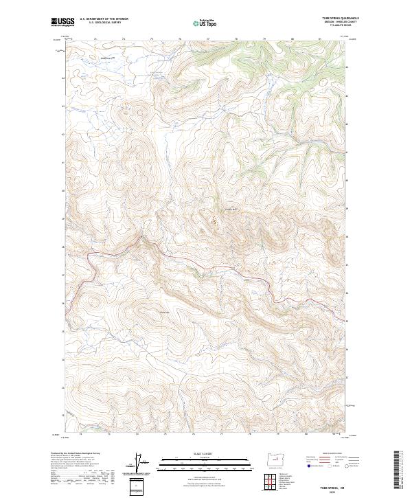
2023 Map of Tubb Spring
USGS Topo · Published 2023About this map
George Iremonger Spring and the nearby Iremonger Spring highlight the historical importance of localized water sources in this high-desert landscape of Wheeler County. The terrain is defined by prominent topographical markers such as Juniper Butte and the broad expanse of Waterman Flat. A complex system of seasonal and perennial drainages including Tubb Creek, Deep Creek, and Indian Creek carve through the ridges, illustrating the natural water-collection patterns vital for ranching and land use in central Oregon. In the southern reach of the survey, Antone Ln provides one of the few named corridors through the varied elevations surrounding Table Mtn. These numerous named springs, from High Gilchrist Spring to the namesake Tubb Spring, signify the reliance on specific geographic points for sustenance in a region where water often dictates the bounds of human activity.
Find a feature on this map
18 named features on this map. Tap any name to fly to it.
Don’t see what you’re looking for? This feature index may not catch every label — zoom into the map to look around manually.
Map Details
Editions of this 2023 Tubb Spring Map
This is the sole edition of this map. No revisions or reprints were ever made.
Other maps of this area

1932 · Dayville
USGS Topo · 1:125,000

1936 · Dayville
USGS Topo · 1:125,000

1953 · Richmond
USGS Topo · 1:62,500

1953 · Picture
USGS Topo · 1:62,500

1955 · Canyon City
USGS Topo · 1:250,000

1959 · Canyon City
USGS Topo · 1:250,000

1966 · Antone
USGS Topo · 1:24,000
1966 · Derr Meadows
USGS Topo · 1:24,000

1972 · Day Basin
USGS Topo · 1:24,000

1980 · Monument
USGS Topo · 1:100,000