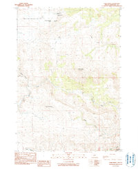
1990 Map of Tubb Spring
USGS Topo · Published 1990About this map
Waterman Flat serves as a prominent high-plateau landmark in this portion of Wheeler County, where the landscape is defined by its complex network of named springs and seasonal drainages. During the late twentieth century, this area remained largely defined by traditional land use and water access, documented here through family-named features such as George Iremonger Spring, Iremonger Spring, Low Gilchrist Spring, and High Gilchrist Spring.
Find a feature on this map
19 named features on this map. Tap any name to fly to it.
Don’t see what you’re looking for? This feature index may not catch every label — zoom into the map to look around manually.
Map Details
Editions of this 1990 Tubb Spring Map
This is the sole edition of this map. No revisions or reprints were ever made.
Other maps of this area

1932 · Dayville
USGS Topo · 1:125,000

1936 · Dayville
USGS Topo · 1:125,000

1953 · Richmond
USGS Topo · 1:62,500

1953 · Picture
USGS Topo · 1:62,500

1955 · Canyon City
USGS Topo · 1:250,000

1959 · Canyon City
USGS Topo · 1:250,000

1966 · Antone
USGS Topo · 1:24,000
1966 · Derr Meadows
USGS Topo · 1:24,000

1972 · Day Basin
USGS Topo · 1:24,000

1980 · Monument
USGS Topo · 1:100,000