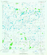
1957 Map of Tuckers Corner
USGS Topo · Published 1967About this map
Hydrology and intricate wetlands dominate this 1950s survey of the Florida interior, where countless small ponds and marshy depressions create a complex water network across the landscape. The Atlantic Coast Line railroad cuts diagonally through the southwest corner, serving as the primary transit artery for this sparsely settled region. Human presence is concentrated around the small crossroads of Tuckers Corner in the northeast and the settlement of Hickman to the south. This map captures the rural boundary where Charlotte Co meets Lee Co, showing the area before extensive drainage or modern development altered the natural flow of these southwest Florida flatwoods. The dense clustering of seasonal water bodies illustrates the historic environmental character of the region prior to mid-century land reclamation efforts.
Find a feature on this map
4 named features on this map. Tap any name to fly to it.
Don’t see what you’re looking for? This feature index may not catch every label — zoom into the map to look around manually.
Map Details
Editions of this 1957 Tuckers Corner Map
3 editions found
Other maps of this area

1956 · Telegraph Swamp
USGS Topo · 1:24,000

1956 · Cleveland
USGS Topo · 1:24,000

1956 · Telegraph Swamp NW
USGS Topo · 1:24,000

1956 · Bermont
USGS Topo · 1:24,000

1956 · West Palm Beach
USGS Topo · 1:250,000

1957 · West Palm Beach
USGS Topo · 1:250,000

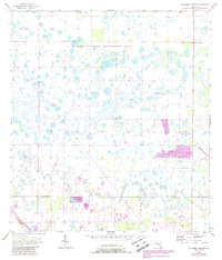
1957 · Tuckers Corner
USGS Topo · 1:24,000

1957 · Gilchrist
USGS Topo · 1:24,000

1958 · West Palm Beach
USGS Topo · 1:250,000

1958 · Fort Myers NW
USGS Topo · 1:24,000