
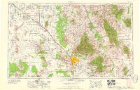
1959 Map of Tucson
USGS Topo · Published 1959About this map
Tucson serves as the focal point of this late-1950s landscape, flanked by the massive Santa Catalina Mountains and the expansive Coronado National Forest. This era shows a region balancing rapid military and industrial expansion with deep-rooted agricultural patterns. To the southeast of the city, Davis-Monthan Air Force Base is a prominent fixture, while the Marana Air Base sits further northwest near Marana. The industrial footprint of the copper industry is evident at the San Manuel Mine and the Silver Bell Mine.
Find a feature on this map
73 named features on this map. Tap any name to fly to it.
Don’t see what you’re looking for? This feature index may not catch every label — zoom into the map to look around manually.
Map Details
Editions of this 1959 Tucson Map
2 editions found
Other maps of this area

1900 · Florence
USGS Topo · 1:125,000

1902 · Florence
USGS Topo · 1:125,000

1904 · Patagonia
USGS Topo · 1:125,000

1904 · Tucson
USGS Topo · 1:125,000

1905 · Patagonia
USGS Topo · 1:125,000

1905 · Tucson
USGS Topo · 1:125,000

1907 · Sacaton
USGS Topo · 1:62,500

1910 · Ray
USGS Topo · 1:62,500

1911 · Winkelman
USGS Topo · 1:125,000

1913 · Winkelman
USGS Topo · 1:125,000