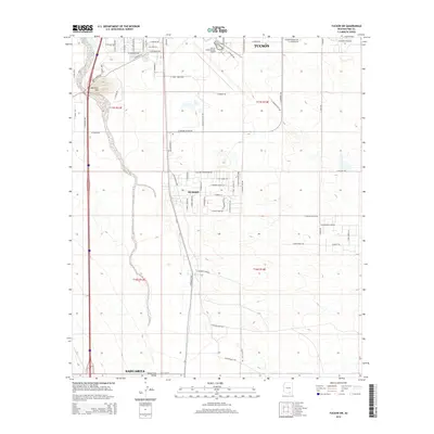
2014 Map of Tucson SW
USGS Topo · Published 2014About this map
Santa Cruz River drainage defines the western landscape of this portion of the Santa Cruz Valley, where modern water management and aviation dominate the desert floor. In the northern reaches, the sprawling footprint of the Tucson International Airport and its complex network of support roads like E Aero Park Blvd and E Airport Dr highlight the area's role as a regional transportation hub. The Central Arizona Project Aqueduct cuts through the southwestern corner, illustrating the engineered infrastructure required to support the growing populations of Tucson and Sahuarita. Between these larger hubs, the smaller settlement of Summit sits near the intersection of S Nogales Hwy and several residential streets. Elevations rise slightly at Martinez Hill, providing a topographic contrast to the otherwise steady grades of the valley floor.
Find a feature on this map
70 named features on this map. Tap any name to fly to it.
Don’t see what you’re looking for? This feature index may not catch every label — zoom into the map to look around manually.
Map Details
Editions of this 2014 Tucson SW Map
This is the sole edition of this map. No revisions or reprints were ever made.
Other maps of this area

1904 · Patagonia
USGS Topo · 1:125,000

1904 · Tucson
USGS Topo · 1:125,000

1905 · Patagonia
USGS Topo · 1:125,000

1905 · Tucson
USGS Topo · 1:125,000

1920 · Arivaca
USGS Topo · 1:125,000

1925 · Samaniego Peak
USGS Topo · 1:62,500

1925 · San Xavier
USGS Topo · 1:62,500

1926 · Helvetia
USGS Topo · 1:62,500

1934 · Tucson Mountains
USGS Topo · 1:125,000

1939 · Twin Buttes
USGS Topo · 1:62,500