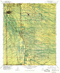
1968 Map of Tucson SW
USGS Topo · Published 1969About this map
Martinez Hill dominates the landscape above the Santa Cruz River in this orthophotomap, which documents the southern outskirts of Tucson in the late 1960s. The map illustrates a unique intersection of indigenous lands and modern infrastructure, with the eastern boundary of the San Xavier Indian Reservation meeting the expanding footprint of the Tucson International Airport. To the south, the terrain transitions into the Sahuarita Bombing and Gunnery Range, highlighting the area's mid-century military and aeronautic significance.
Find a feature on this map
26 named features on this map. Tap any name to fly to it.
Don’t see what you’re looking for? This feature index may not catch every label — zoom into the map to look around manually.
Map Details
Editions of this 1968 Tucson SW Map
3 editions found
Other maps of this area

1904 · Patagonia
USGS Topo · 1:125,000

1904 · Tucson
USGS Topo · 1:125,000

1905 · Patagonia
USGS Topo · 1:125,000

1905 · Tucson
USGS Topo · 1:125,000

1920 · Arivaca
USGS Topo · 1:125,000

1925 · Samaniego Peak
USGS Topo · 1:62,500

1925 · San Xavier
USGS Topo · 1:62,500

1926 · Helvetia
USGS Topo · 1:62,500

1934 · Tucson Mountains
USGS Topo · 1:125,000

1939 · Twin Buttes
USGS Topo · 1:62,500