
1954 Map of Tucumcari
USGS Topo · Published 1965About this map
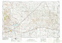
Tucumcari and the surrounding high plains of Eastern New Mexico and the Texas Panhandle are captured here during a period of transition for Western travel and infrastructure. The iconic U.S. 66 cuts a straight line across the landscape, connecting settlements like San Jon, Glenrio, and Vega before the era of modern interstate bypasses. This mid-century view highlights the vital importance of the Canadian River and man-made water features such as Conchas Lake and the Ute Reservoir to this arid ranching country. The intersection of major rail lines, including the Chicago Rock Island and Pacific and the Southern Pacific, underscores the region's role as a transportation hub. Landforms like Tucumcari Mountain and Mesa Redonda stand as distinctive navigational markers against the surrounding Sand Hills, while small communities like Nara Visa and Amistad serve as remote outposts for the area's agricultural and ranching legacy.
Find a feature on this map
61 named features on this map. Tap any name to fly to it.
Don’t see what you’re looking for? This feature index may not catch every label — zoom into the map to look around manually.
Map Details
Editions of this 1954 Tucumcari Map
2 editions found
Other maps of this area

1930 · Tucumcari
USGS Topo · 1:125,000

1934 · Ady
USGS Topo · 1:62,500

1934 · Cliffside
USGS Topo · 1:62,500

1936 · Fourways
USGS Topo · 1:62,500

1936 · Cliffside
USGS Topo · 1:62,500

1936 · Ady
USGS Topo · 1:62,500

1953 · Marsh
USGS Topo · 1:24,000

1953 · Puente
USGS Topo · 1:24,000

1953 · Masterson
USGS Topo · 1:24,000

1953 · Cliffside
USGS Topo · 1:24,000