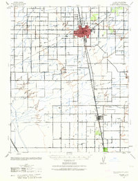
1942 Map of Tulare
USGS Topo · Published 1963About this map
Agricultural development and early irrigation patterns dominate this Central Valley landscape, centered on the growing hub of Tulare. The map reveals a highly structured grid of section lines and water management, where numerous rural schools like Oakland Colony Sch and Linder Sch served the surrounding farming families. This infrastructure is tethered to the critical transport corridors of the Southern Pacific and Atchison Topeka and Santa Fe railroads, which facilitated the movement of goods from the fields to the larger markets.
Find a feature on this map
40 named features on this map. Tap any name to fly to it.
Don’t see what you’re looking for? This feature index may not catch every label — zoom into the map to look around manually.
Map Details
Editions of this 1942 Tulare Map
2 editions found
Other maps of this area

1914 · Lost Hills
USGS Topo · 1:125,000

1925 · Tulare
USGS Topo · 1:31,680

1925 · Tipton
USGS Topo · 1:31,680

1926 · Goshen
USGS Topo · 1:31,680

1926 · Exeter
USGS Topo · 1:31,680

1927 · Cairns Corner
USGS Topo · 1:31,680

1927 · Remnoy
USGS Topo · 1:31,680

1927 · Lake View School
USGS Topo · 1:31,680

1927 · Paige
USGS Topo · 1:31,680

1927 · Visalia
USGS Topo · 1:31,680