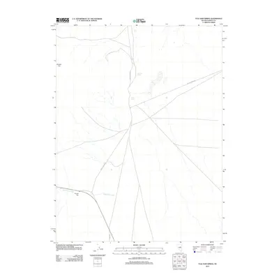
2012 Map of Tule Dam Spring
USGS Topo · Published 2012About this map
Tule Dam Spring and Sulphur Spring anchor this high-desert basin in Eureka Co. at the start of the 21st century. The landscape is defined by the vital presence of water sources in a dry environment, with drainage pathways like Garden Pass Creek flowing toward the southern reaches of the quadrangle. Transportation routes such as Whistler, Sadler-Siri-Union, and Sulfur-Thompson trace paths through the basin floor, likely serving ranching or mining interests common to the region. Topographical breaks in the surrounding ranges are marked by notable natural gateways, specifically Mulligan Gap in the northwest and Tyrone Gap in the southwest. These features indicate the historical movement of livestock and travelers through this part of the Great Basin.
Find a feature on this map
8 named features on this map. Tap any name to fly to it.
Don’t see what you’re looking for? This feature index may not catch every label — zoom into the map to look around manually.
Map Details
Editions of this 2012 Tule Dam Spring Map
This is the sole edition of this map. No revisions or reprints were ever made.
Other maps of this area

1926 · Roberts Mountains
USGS Topo · 1:250,000

1929 · Roberts Mountains
USGS Topo · 1:250,000

1949 · Garden Valley
USGS Topo · 1:62,500

1951 · Garden Valley
USGS Topo · 1:62,500

1953 · Eureka
USGS Topo · 1:62,500

1955 · Millett
USGS Topo · 1:250,000

1956 · Whistler Mtn
USGS Topo · 1:62,500

1956 · Ely
USGS Topo · 1:250,000

1957 · Diamond Springs
USGS Topo · 1:62,500

1959 · Ely
USGS Topo · 1:250,000