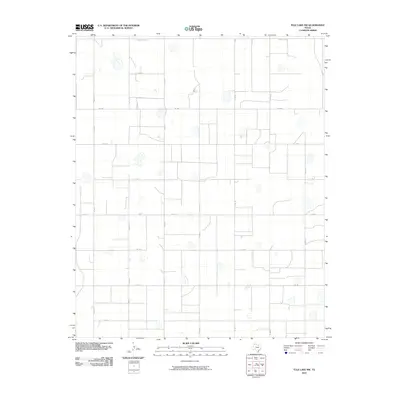
2010 Map of Tule Lake NW
USGS Topo · Published 2010About this map
Agricultural lands in the Panhandle region define this landscape at the turn of the decade, where a strict rectilinear grid of rural roads partitions the territory. The map area is characterized by numerous seasonal depressions or playa lakes scattered across the terrain, interrupting the steady geometric pattern of farm-to-market roads and local county routes. Two primary east-west arteries, Fm 1881 and Fm 146, anchor the transport network, facilitating the movement of livestock and crops through Randall County. North-south corridors such as Co Rd 17 and Co Rd 18 connect isolated farmsteads and rural properties to the wider regional infrastructure. This survey captures a moment of modern rural continuity, where the boundaries established by County Line Rd and various lettered routes like Co Rd B and Co Rd D trace the legacy of early Texas land surveying.
Find a feature on this map
16 named features on this map. Tap any name to fly to it.
Don’t see what you’re looking for? This feature index may not catch every label — zoom into the map to look around manually.
Map Details
Editions of this 2010 Tule Lake NW Map
This is the sole edition of this map. No revisions or reprints were ever made.
Other maps of this area

1954 · Plainview
USGS Topo · 1:250,000

1958 · Plainview
USGS Topo · 1:250,000

1960 · Canyon
USGS Topo · 1:62,500

1960 · Wayside
USGS Topo · 1:62,500

1965 · Tulia
USGS Topo · 1:24,000

1965 · Happy
USGS Topo · 1:24,000

1968 · Tule Lake
USGS Topo · 1:24,000

1969 · Love
USGS Topo · 1:24,000

1969 · Jackson Hill
USGS Topo · 1:24,000

1969 · Tule Lake NW
USGS Topo · 1:24,000