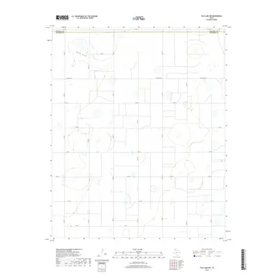
2019 Map of Tule Lake NW
USGS Topo · Published 2019About this map
Happy Draw winds through the northern portion of this High Plains landscape, characterizing the seasonal drainage patterns of the Texas Panhandle. The map illustrates a strictly organized agricultural grid, with the Randall Co and Swisher Co boundary cutting across the northern reaches. This rural expanse is defined by its network of section-line roads, including Ranch Rd 1881 and several county roads such as Co Rd 15 and Co Rd 19. The infrastructure shown here is typical of modern ranching and farming operations, where large-scale land parcels are accessed via state-maintained routes like FM 1075 and FM 146. For the local historian or researcher, the map preserves the exact alignment of property access and county borders as they existed in the late 2010s.
Find a feature on this map
18 named features on this map. Tap any name to fly to it.
Don’t see what you’re looking for? This feature index may not catch every label — zoom into the map to look around manually.
Map Details
Editions of this 2019 Tule Lake NW Map
This is the sole edition of this map. No revisions or reprints were ever made.
Other maps of this area

1954 · Plainview
USGS Topo · 1:250,000

1958 · Plainview
USGS Topo · 1:250,000

1960 · Canyon
USGS Topo · 1:62,500

1960 · Wayside
USGS Topo · 1:62,500

1965 · Tulia
USGS Topo · 1:24,000

1965 · Happy
USGS Topo · 1:24,000

1968 · Tule Lake
USGS Topo · 1:24,000

1969 · Love
USGS Topo · 1:24,000

1969 · Jackson Hill
USGS Topo · 1:24,000

1969 · Tule Lake NW
USGS Topo · 1:24,000