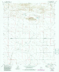
1973 Map of Tule Lake
USGS Topo · Published 1987About this map
Cañada del Tule meanders through this arid ranching landscape in Roosevelt and Curry Counties, providing the primary drainage for a region defined by its dispersed water sources. The importance of groundwater for survival and industry is evident in the numerous named points across the map, including Forty Acre Well, East Sweet Well, and Brown Well. The landscape is a mix of stable terrain and ephemeral hydrology, represented by Little Tule Lake and areas of Shifting Sand. Human settlement is sparse and tied to the land's agricultural output, anchored by the Hart Ranch and Steele Ranch. Remote thoroughfares like Sun Dale Valley Road connect these isolated holdings, while the boundary between Curry and Roosevelt Counties cuts a straight line through the basin.
Find a feature on this map
24 named features on this map. Tap any name to fly to it.
Don’t see what you’re looking for? This feature index may not catch every label — zoom into the map to look around manually.
Map Details
Editions of this 1973 Tule Lake Map
2 editions found
Other maps of this area

1954 · Clovis
USGS Topo · 1:250,000

1957 · Melrose
USGS Topo · 1:62,500

1958 · Clovis
USGS Topo · 1:250,000

1972 · Melrose East
USGS Topo · 1:24,000

1973 · Floyd
USGS Topo · 1:24,000

1973 · Krider
USGS Topo · 1:24,000

1973 · Melrose West
USGS Topo · 1:24,000

1973 · Tule Lake
USGS Topo · 1:24,000

1973 · Gammil Well NE
USGS Topo · 1:24,000

1973 · Upton
USGS Topo · 1:24,000