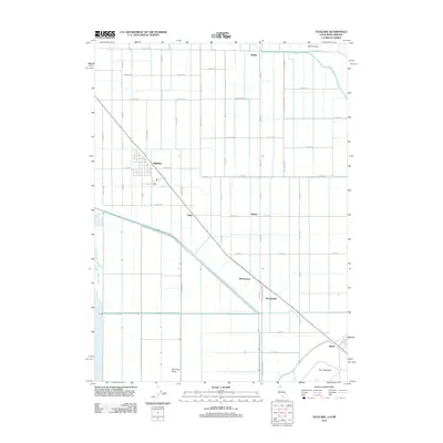
2012 Map of Tulelake
USGS Topo · Published 2012About this map
Tulelake serves as the primary hub for this fertile agricultural basin along the California-Oregon border, where a grid of irrigation canals and rural roads defines the landscape. The geography is dominated by the remnants of Tule Lake and the significant hydraulic engineering of the J Canal, which transformed the region's marshes into productive farmland. Small communities and loading points like Stronghold, Homestead, and Tuber are situated along the Great Northern Rd line, reflecting the vital connection between local growers and distant markets. The northern edge of the map follows State Line Rd, which marks the boundary between Siskiyou County and its northern neighbor. Land features such as The Peninsula and The Frog Pond offer glimpses into the original topography that existed before the comprehensive reclamation efforts of the 20th century.
Find a feature on this map
32 named features on this map. Tap any name to fly to it.
Don’t see what you’re looking for? This feature index may not catch every label — zoom into the map to look around manually.
Map Details
Editions of this 2012 Tulelake Map
This is the sole edition of this map. No revisions or reprints were ever made.
Other maps of this area

1886 · Modoc Lava Bed
USGS Topo · 1:250,000

1889 · Klamath
USGS Topo · 1:250,000

1892 · Modoc Lava-Bed
USGS Topo · 1:250,000

1894 · Klamath
USGS Topo · 1:250,000

1950 · Mt. Dome
USGS Topo · 1:62,500

1951 · Tulelake
USGS Topo · 1:62,500

1954 · Alturas
USGS Topo · 1:250,000

1955 · Klamath Falls
USGS Topo · 1:250,000

1957 · Merrill
USGS Topo · 1:62,500

1957 · Malin
USGS Topo · 1:62,500