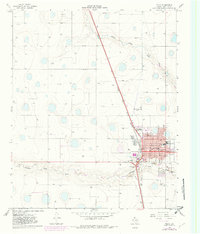
1965 Map of Tulia
USGS Topo · Published 1982About this map
Tulia serves as the focal point of this High Plains survey, positioned at a critical junction of the Atchison Topeka and Santa Fe railroad and regional highways. The town's mid-century infrastructure is well-defined, showing a concentrated civic core with the Courthouse, City Hall, and the Armory. Educational and community spaces are prominent, including the High School, Junior High School, and Adair Park.
Find a feature on this map
25 named features on this map. Tap any name to fly to it.
Don’t see what you’re looking for? This feature index may not catch every label — zoom into the map to look around manually.
Map Details
Editions of this 1965 Tulia Map
2 editions found
Other maps of this area

1954 · Plainview
USGS Topo · 1:250,000

1958 · Plainview
USGS Topo · 1:250,000

1965 · Edmonson NE
USGS Topo · 1:24,000

1965 · Tulia
USGS Topo · 1:24,000

1965 · Lakeview
USGS Topo · 1:24,000

1965 · Happy
USGS Topo · 1:24,000

1965 · Center Plains School
USGS Topo · 1:24,000

1966 · Tulia NW
USGS Topo · 1:24,000

1968 · Tule Lake
USGS Topo · 1:24,000

1969 · Tule Lake NW
USGS Topo · 1:24,000