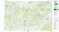
1981 Map of Tullahoma
USGS Topo · Published 1982About this map
The Duck River and Elk River systems carve through the heart of this Southern Tennessee landscape, defining the transition from the Cumberland Plateau into the fertile basin below. Central to this 1980s-era study is the massive Arnold Engineering Development Center, a sprawling technological hub flanked by Woods Reservoir and the University of Tennessee Space Institute. This aerospace infrastructure stands in contrast to the agricultural heritage of the surrounding counties, where historic transport routes like the L & N RR connect the regional hubs of Shelbyville, Tullahoma, and Fayetteville.
Find a feature on this map
114 named features on this map. Tap any name to fly to it.
Don’t see what you’re looking for? This feature index may not catch every label — zoom into the map to look around manually.
Map Details
Editions of this 1981 Tullahoma Map
This is the sole edition of this map. No revisions or reprints were ever made.
Other maps of this area

1886 · Stevenson
USGS Topo · 1:125,000

1888 · Scottsboro
USGS Topo · 1:125,000

1888 · Huntsville
USGS Topo · 1:125,000

1892 · Huntsville
USGS Topo · 1:125,000

1892 · Scottsboro
USGS Topo · 1:125,000

1892 · Stevenson
USGS Topo · 1:125,000

1893 · Mc Minnville
USGS Topo · 1:125,000

1895 · Stevenson
USGS Topo · 1:125,000

1895 · Mc Minnville
USGS Topo · 1:125,000

1895 · Sewanee
USGS Topo · 1:125,000