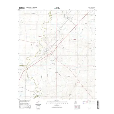
2015 Map of Tullos
USGS Topo · Published 2015About this map
Urania and Tullos serve as the primary hubs in this central Louisiana landscape, where the borders of LaSalle, Winn, and Grant Parishes converge. The map documents a territory defined by its complex drainage network, anchored by the meandering course of the Little River and numerous tributaries like Chickasaw Creek and Cochran Cr. The distribution of infrastructure reflects the region's historical reliance on the timber and oil industries, with Oil Field RD and various "parish roads" threading through the pine woods to reach dispersed settlements and family landholdings.
Find a feature on this map
81 named features on this map. Tap any name to fly to it.
Don’t see what you’re looking for? This feature index may not catch every label — zoom into the map to look around manually.
Map Details
Editions of this 2015 Tullos Map
This is the sole edition of this map. No revisions or reprints were ever made.
Other maps of this area

1936 · Pollock
USGS Topo · 1:62,500

1941 · Jena
USGS Topo · 1:62,500

1941 · Pollock
USGS Topo · 1:62,500

1953 · Alexandria
USGS Topo · 1:250,000

1954 · Tullos
USGS Topo · 1:62,500

1955 · Alexandria
USGS Topo · 1:250,000

1955 · Olla
USGS Topo · 1:62,500

1958 · Pollock
USGS Topo · 1:62,500

1958 · Jena
USGS Topo · 1:62,500
1984 · Flat Creek
USGS Topo · 1:24,000