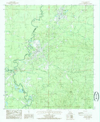
1984 Map of Tullos
USGS Topo · Published 1985About this map
The Missouri Pacific railroad corridor anchors this mid-1980s landscape, connecting the industrial and residential centers of Urania and Tullos. This area is defined by its extraction history, with numerous Oil Field notations and pipelines crisscrossing the terrain between Castor Creek and Chickasaw Creek. The confluence of the Dugdemona River and Little River near the border of Winn Parish and La Salle Parish reveals a complex network of wetlands and shifting channels, while the presence of Abnd R R and Old R R Rd traces the remnants of earlier timber or transit routes. Settlements like Rochelle, Grandstaff, and Georgetown are positioned along the primary transport lines, surrounded by a low-lying landscape that rises to the singular local peak of Mountain Hill.
Find a feature on this map
29 named features on this map. Tap any name to fly to it.
Don’t see what you’re looking for? This feature index may not catch every label — zoom into the map to look around manually.
Map Details
Editions of this 1984 Tullos Map
This is the sole edition of this map. No revisions or reprints were ever made.
Other maps of this area

1936 · Pollock
USGS Topo · 1:62,500

1941 · Jena
USGS Topo · 1:62,500

1941 · Pollock
USGS Topo · 1:62,500

1953 · Alexandria
USGS Topo · 1:250,000

1954 · Tullos
USGS Topo · 1:62,500

1955 · Alexandria
USGS Topo · 1:250,000

1955 · Olla
USGS Topo · 1:62,500

1958 · Pollock
USGS Topo · 1:62,500

1958 · Jena
USGS Topo · 1:62,500
1984 · Flat Creek
USGS Topo · 1:24,000