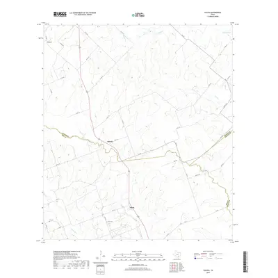
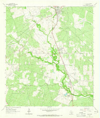
2019 Map of Tulsita
USGS Topo · Published 2019About this map
Tulsita and the surrounding South Texas countryside are defined by a complex network of intermittent streams and farm-to-market roads along the triple border of Karnes, Bee, and Goliad counties. The settlement of Tulsita serves as a local hub near the southern edge of the map, while Burnell and Green sit further north along the primary highway corridor. The landscape is deeply carved by drainage systems including Medio Cr, Blanco Cr, and Hondo Cr, which dictate the winding paths of rural routes like FM 743. Genealogists and local historians will find significant value in the location of the Pettus Cem and Dahl Cem, which anchor the history of these farming communities. The map captures a late-decade view of a ranching and agricultural region where traditional county lines—such as the Karnes Co Bee Co boundary—intersect with a modernizing infrastructure of rural roads.
Find a feature on this map
41 named features on this map. Tap any name to fly to it.
Don’t see what you’re looking for? This feature index may not catch every label — zoom into the map to look around manually.
Map Details
Editions of this 2019 Tulsita Map
This is the sole edition of this map. No revisions or reprints were ever made.
Other maps of this area

1936 · Pettus
USGS Topo · 1:62,500

1953 · Beeville
USGS Topo · 1:250,000

1956 · Beeville
USGS Topo · 1:250,000

1956 · Pettus
USGS Topo · 1:62,500

1956 · Karnes City
USGS Topo · 1:62,500

1960 · Beeville
USGS Topo · 1:250,000
1961 · Kenedy
USGS Topo · 1:24,000
1961 · Lenz
USGS Topo · 1:24,000
1963 · Monteola
USGS Topo · 1:24,000
1963 · Tuleta
USGS Topo · 1:24,000