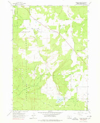
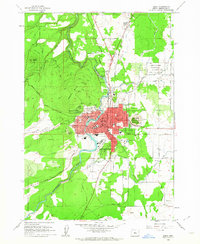
1962 Map of Tumalo Dam
USGS Topo · Published 1978About this map
The agricultural and hydraulic infrastructure of central Oregon takes center stage in this 1962 survey. The settlement of Plainview serves as a local hub, supported by community landmarks such as the Plainview Sch and a Grange Hall. The map illustrates a landscape shaped by water management, featuring a complex network of irrigation that includes the Plainview Ditch, the Columbia Southern Canal, and the Tyler Road Canal.
Find a feature on this map
28 named features on this map. Tap any name to fly to it.
Don’t see what you’re looking for? This feature index may not catch every label — zoom into the map to look around manually.
Map Details
Editions of this 1962 Tumalo Dam Map
4 editions found
Other maps of this area

1926 · Bend
USGS Topo · 1:125,000

1929 · Bend
USGS Topo · 1:125,000

1929 · Three Sisters
USGS Topo · 1:125,000

1932 · Three Sisters
USGS Topo · 1:125,000

1955 · Bend
USGS Topo · 1:250,000

1957 · Bend
USGS Topo · 1:250,000

1958 · Bend
USGS Topo · 1:250,000

1959 · Broken Top
USGS Topo · 1:62,500

1959 · Sisters
USGS Topo · 1:62,500
1962 · Bend
USGS Topo · 1:24,000