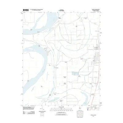
2011 Map of Tunica
USGS Topo · Published 2011About this map
The Mississippi River creates a dynamic western boundary for this delta landscape, shaped by centuries of alluvial shifts at Mhoon Bend and Fox Island Bend. The interior is defined by a dense network of drainage and commerce, featuring Tunica as the primary hub alongside the smaller settlements of Austin and Evansville. The land use reflects a specialized local economy, prominently marked by the Wesley Bailey Catfish Pond Dam and several other aquaculture structures that illustrate the region's relationship with water and agriculture.
Find a feature on this map
64 named features on this map. Tap any name to fly to it.
Don’t see what you’re looking for? This feature index may not catch every label — zoom into the map to look around manually.
Map Details
Editions of this 2011 Tunica Map
This is the sole edition of this map. No revisions or reprints were ever made.
Other maps of this area

1908 · Dundee
USGS Topo · 1:24,000

1908 · Hollywood
USGS Topo · 1:24,000

1908 · Walnut Lake
USGS Topo · 1:24,000

1910 · Dundee
USGS Topo · 1:31,680

1910 · Walnut Lake
USGS Topo · 1:31,680

1913 · Hollywood
USGS Topo · 1:31,680

1931 · Horseshoe Lake
USGS Topo · 1:62,500

1939 · Clayton
USGS Topo · 1:62,500

1939 · Horseshoe Lake
USGS Topo · 1:62,500

1939 · Park Place
USGS Topo · 1:62,500