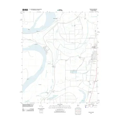
2012 Map of Tunica
USGS Topo · Published 2012About this map
Mississippi River bends and oxbows dominate this river-delta landscape, where the shifting waters have carved out features like Mhoon Bend and Fox Island Bend. The town of Tunica sits inland from the current riverbank, supported by smaller waterways such as McKinney Bayou and White Oak Bayou. The map reveals a dense network of local cemeteries including Oakwood Cem, Saint Johns Cem, and Crystal Springs Cem, which provide significant points of interest for genealogical research in this part of the Delta. Settlements such as Austin and Evansville are situated near the banks of Tunica Lake, while the modern Tunica Airport marks the growth of regional infrastructure. Navigation and flood control remain central to the geography here, evidenced by the Mhoon Bend Revetment and the extensive Levee Rd system that parallels the river's path.
Find a feature on this map
74 named features on this map. Tap any name to fly to it.
Don’t see what you’re looking for? This feature index may not catch every label — zoom into the map to look around manually.
Map Details
Editions of this 2012 Tunica Map
This is the sole edition of this map. No revisions or reprints were ever made.
Other maps of this area

1908 · Dundee
USGS Topo · 1:24,000

1908 · Hollywood
USGS Topo · 1:24,000

1908 · Walnut Lake
USGS Topo · 1:24,000

1910 · Dundee
USGS Topo · 1:31,680

1910 · Walnut Lake
USGS Topo · 1:31,680

1913 · Hollywood
USGS Topo · 1:31,680

1931 · Horseshoe Lake
USGS Topo · 1:62,500

1939 · Clayton
USGS Topo · 1:62,500

1939 · Horseshoe Lake
USGS Topo · 1:62,500

1939 · Park Place
USGS Topo · 1:62,500