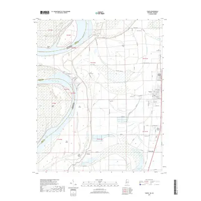
2018 Map of Tunica
USGS Topo · Published 2018About this map
The Mississippi River forms a complex boundary between Arkansas and Mississippi in this region, shaping the landscape through its dramatic meanders at Mhoon Bend and Fox Island Bend. The town of Tunica and its neighbor North Tunica serve as local centers near the eastern edge of the flood plain, while smaller settlements like Austin and Evansville are situated further south and west. The area is dense with family and community history, evidenced by a high concentration of cemeteries such as Mount Nebo Cem and Crystal Springs Cem.
Find a feature on this map
84 named features on this map. Tap any name to fly to it.
Don’t see what you’re looking for? This feature index may not catch every label — zoom into the map to look around manually.
Map Details
Editions of this 2018 Tunica Map
This is the sole edition of this map. No revisions or reprints were ever made.
Other maps of this area

1908 · Dundee
USGS Topo · 1:24,000

1908 · Hollywood
USGS Topo · 1:24,000

1908 · Walnut Lake
USGS Topo · 1:24,000

1910 · Dundee
USGS Topo · 1:31,680

1910 · Walnut Lake
USGS Topo · 1:31,680

1913 · Hollywood
USGS Topo · 1:31,680

1931 · Horseshoe Lake
USGS Topo · 1:62,500

1939 · Clayton
USGS Topo · 1:62,500

1939 · Horseshoe Lake
USGS Topo · 1:62,500

1939 · Park Place
USGS Topo · 1:62,500