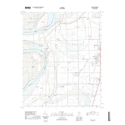
2020 Map of Tunica
USGS Topo · Published 2020About this map
The Mississippi River meanders through this portion of the Delta, shaping the landscape near the Tunica County Courthouse. The town of Tunica serves as a central hub, flanked by North Tunica and the smaller settlements of Austin and Evansville. This area is defined by its relation to the river's historical shifts, evidenced by large features like Mhoon Bend, Fox Island Bend, and Ship Island Bend. The topography is crisscrossed by drainage and water systems including McKinney Bayou, Anderson Bayou, and Tunica Lake.
Find a feature on this map
87 named features on this map. Tap any name to fly to it.
Don’t see what you’re looking for? This feature index may not catch every label — zoom into the map to look around manually.
Map Details
Editions of this 2020 Tunica Map
This is the sole edition of this map. No revisions or reprints were ever made.
Other maps of this area

1908 · Dundee
USGS Topo · 1:24,000

1908 · Hollywood
USGS Topo · 1:24,000

1908 · Walnut Lake
USGS Topo · 1:24,000

1910 · Dundee
USGS Topo · 1:31,680

1910 · Walnut Lake
USGS Topo · 1:31,680

1913 · Hollywood
USGS Topo · 1:31,680

1931 · Horseshoe Lake
USGS Topo · 1:62,500

1939 · Clayton
USGS Topo · 1:62,500

1939 · Horseshoe Lake
USGS Topo · 1:62,500

1939 · Park Place
USGS Topo · 1:62,500