2023 Map of Tunkhannock
USGS Topo · Published 2023About this map
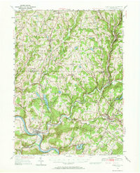
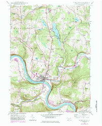
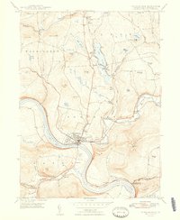
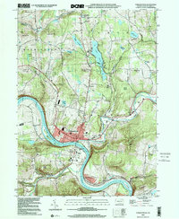
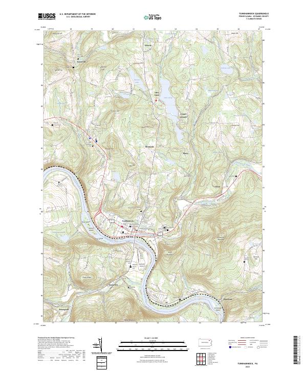
Tunkhannock serves as the focal point of this Pennsylvania landscape, where the Susquehanna River meets Tunkhannock Creek. The town center is densely detailed, featuring the Wyoming County Courthouse and numerous historical burial grounds such as Gravel Hill Cem and Sunnyside Cem. The topography is defined by significant elevations like Miller Mountain to the south and Avery Mountain rising above the river's bend. North of the borough, Lake Carey and its namesake settlement represent a distinct recreation and residential cluster, while Skyhaven Airport sits tucked between the river and Bowman Creek. This documentation of Wyoming County highlights the persistent settlement patterns around Eatonville and Dixon, alongside numerous family-named landmarks like the Lee Homestead Cem and Russell-Prevost Cem that offer significant value for genealogical research in the region.
Find a feature on this map
176 named features on this map. Tap any name to fly to it.
Don’t see what you’re looking for? This feature index may not catch every label — zoom into the map to look around manually.
Map Details
Editions of this 2023 Tunkhannock Map
This is the sole edition of this map. No revisions or reprints were ever made.
Historical Maps of Kaiserville Through Time
5 maps found