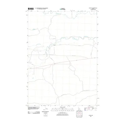
2010 Map of Tunupa
USGS Topo · Published 2010About this map
Tunupa and its surrounding agricultural plains in Gooding County are defined by a complex network of water management and historic transit routes. The landscape is dominated by the convergent paths of the Big Wood River and the Little Wood River, which provide the essential irrigation for this high desert region. Evidence of early 21st-century water engineering is visible through the South Gooding Main Canal, Lateral B 1, and the Sliman Reservoir to the northwest. A notable connection to the area's pastoral heritage is preserved in the Wendell-Shoshone Sheep Trl, which meanders across the southern portion of the map. This route, alongside the Old Gooding Hwy, reflects the historical movement of livestock and commerce between regional centers before modern highway developments shifted local travel patterns.
Find a feature on this map
11 named features on this map. Tap any name to fly to it.
Don’t see what you’re looking for? This feature index may not catch every label — zoom into the map to look around manually.
Map Details
Editions of this 2010 Tunupa Map
This is the sole edition of this map. No revisions or reprints were ever made.
Other maps of this area

1955 · Twin Falls
USGS Topo · 1:250,000

1955 · Hailey
USGS Topo · 1:250,000

1957 · Thorn Creek SE
USGS Topo · 1:24,000

1957 · Thorn Creek SW
USGS Topo · 1:24,000

1957 · Thorn Creek
USGS Topo · 1:62,500

1958 · Twin Falls
USGS Topo · 1:250,000

1959 · Hailey
USGS Topo · 1:250,000

1962 · Hailey
USGS Topo · 1:250,000
1971 · Wendell
USGS Topo · 1:24,000

1971 · Tunupa
USGS Topo · 1:24,000