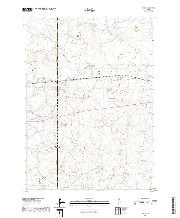
2024 Map of Tunupa
USGS Topo · Published 2024About this map
Little Wood River meanders through this agricultural landscape, defining the character of a region heavily shaped by irrigation and ranching infrastructure. The small settlement of Tunupa sits at a junction of local routes, including Pole Line Rd and Ohlinger Rd, illustrating the grid-based development of the Idaho plains. The intricate network of water management is visible through features like the South Gooding Main Canal, Slitman Reservoir, and various laterals such as Lateral 916C1B. A notable historical trace is the Wendell-Shoshone Sheep Trl, which cuts across the southern township lines, suggesting the long-standing importance of livestock movement in this high-desert environment. The map also records the boundary between Gooding County and Lincoln County, dividing the western and eastern halves of this surveyed area.
Find a feature on this map
21 named features on this map. Tap any name to fly to it.
Don’t see what you’re looking for? This feature index may not catch every label — zoom into the map to look around manually.
Map Details
Editions of this 2024 Tunupa Map
This is the sole edition of this map. No revisions or reprints were ever made.
Other maps of this area

1955 · Twin Falls
USGS Topo · 1:250,000

1955 · Hailey
USGS Topo · 1:250,000

1957 · Thorn Creek SE
USGS Topo · 1:24,000

1957 · Thorn Creek SW
USGS Topo · 1:24,000

1957 · Thorn Creek
USGS Topo · 1:62,500

1958 · Twin Falls
USGS Topo · 1:250,000

1959 · Hailey
USGS Topo · 1:250,000

1962 · Hailey
USGS Topo · 1:250,000
1971 · Wendell
USGS Topo · 1:24,000

1971 · Tunupa
USGS Topo · 1:24,000