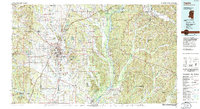
1984 Map of Tupelo
USGS Topo · Published 1985About this map
The Tombigbee River and Buttahatchee River drainage basins define this 1984 survey, which documents the landscape of Northeast Mississippi and Northwest Alabama just before significant modern expansion. This map illustrates the vital intersection of rail and road transport, featuring the Illinois Central Gulf corridor and the historic Old Natchez Trace Parkway. Large-scale conservation and management areas are prominent, including the Tombigbee National Forest, Chickasaw Game Management Area, and the John Bell Williams Wildlife Mgt Area. Local genealogists will find the distribution of smaller communities like Guntown, Saltillo, and New Albany particularly useful for tracing late 20th-century family history. The topography shifts from the Birmingham Ridge in the west to the Freedom Hills and Bear Creek Valley in the east, providing a clear record of the region’s timber and agricultural terrain.
Find a feature on this map
106 named features on this map. Tap any name to fly to it.
Don’t see what you’re looking for? This feature index may not catch every label — zoom into the map to look around manually.
Map Details
Editions of this 1984 Tupelo Map
This is the sole edition of this map. No revisions or reprints were ever made.
Other maps of this area

1921 · Booneville
USGS Topo · 1:48,000

1921 · Tupelo
USGS Topo · 1:48,000

1922 · Booneville
USGS Topo · 1:62,500

1923 · Tupelo
USGS Topo · 1:62,500

1925 · Barton
USGS Topo · 1:62,500

1926 · Barton
USGS Topo · 1:48,000

1929 · Barton
USGS Topo · 1:62,500

1935 · Pleasant Site
USGS Topo · 1:24,000

1936 · Belmont
USGS Topo · 1:24,000

1936 · Pleasant Grove
USGS Topo · 1:24,000