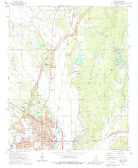
1973 Map of Tupelo
USGS Topo · Published 1988About this map
Tupelo and its surrounding Lee County landscapes are documented here in the early 1970s, revealing a region where deep historical roots meet mid-century modernization. The map highlights significant cultural sites such as the Tupelo National Battlefield and the Chickasaw Village Site, underscoring the area's long-standing strategic importance. The city's growth is anchored by the Gulf Mobile and Ohio and St Louis - San Francisco railroads, which intersect near the downtown core.
Find a feature on this map
69 named features on this map. Tap any name to fly to it.
Don’t see what you’re looking for? This feature index may not catch every label — zoom into the map to look around manually.
Map Details
Editions of this 1973 Tupelo Map
2 editions found
Other maps of this area

1921 · Tupelo
USGS Topo · 1:48,000

1923 · Tupelo
USGS Topo · 1:62,500

1955 · Sherman
USGS Topo · 1:62,500

1956 · Tupelo
USGS Topo · 1:250,000

1958 · Tupelo
USGS Topo · 1:250,000

1965 · Mooreville
USGS Topo · 1:24,000

1966 · Evergreen
USGS Topo · 1:24,000

1966 · Bissell
USGS Topo · 1:24,000

1966 · Verona
USGS Topo · 1:24,000

1973 · Guntown
USGS Topo · 1:24,000