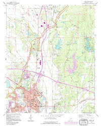
1992 Map of Tupelo
USGS Topo · Published 1995About this map
Tupelo and its surrounding Lee County landscape appear in this 1990s record of urban expansion and preserved history. The city's core is detailed with civic landmarks like the Courthouse and Tupelo City Hall, while the western edge is anchored by the Tupelo National Battlefield and the Chickasaw Village Site, reflecting layers of conflict and settlement. The Natchez Trace Parkway carves a diagonal path across the terrain, passing the Old Town Overlook and the Beech Springs community.
Find a feature on this map
64 named features on this map. Tap any name to fly to it.
Don’t see what you’re looking for? This feature index may not catch every label — zoom into the map to look around manually.
Map Details
Editions of this 1992 Tupelo Map
2 editions found
Other maps of this area

1921 · Tupelo
USGS Topo · 1:48,000

1923 · Tupelo
USGS Topo · 1:62,500

1955 · Sherman
USGS Topo · 1:62,500

1956 · Tupelo
USGS Topo · 1:250,000

1958 · Tupelo
USGS Topo · 1:250,000

1965 · Mooreville
USGS Topo · 1:24,000

1966 · Evergreen
USGS Topo · 1:24,000

1966 · Bissell
USGS Topo · 1:24,000

1966 · Verona
USGS Topo · 1:24,000

1973 · Guntown
USGS Topo · 1:24,000