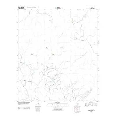
2013 Map of Turkey Knob
USGS Topo · Published 2013About this map
Turkey Knob and Cloud Mountain anchor this central Texas landscape, where the topography is defined by a dense network of creek drainages and secluded hollows. Small private cemeteries like Langridge Family Cem and Polly Cem provide significant points of interest for genealogists tracing local families. The southern portion of the map shows a concentrated pattern of residential development near Castle Lake, with roads like Roller Coaster Rd and N Goat Rdg winding through the terrain. Numerous water sources, including Sycamore Spring and Wagner Spring, suggest a reliance on natural springs common to the region's geography. The map also documents a series of larger water bodies such as Youngblood Lake and Berry Lake, which contrast with the dry, winding beds of Bear Creek and Privilege Creek.
Find a feature on this map
61 named features on this map. Tap any name to fly to it.
Don’t see what you’re looking for? This feature index may not catch every label — zoom into the map to look around manually.
Map Details
Editions of this 2013 Turkey Knob Map
This is the sole edition of this map. No revisions or reprints were ever made.
Other maps of this area

1954 · San Antonio
USGS Topo · 1:250,000

1956 · Comfort
USGS Topo · 1:62,500

1956 · Bandera
USGS Topo · 1:62,500

1956 · Medina Lake
USGS Topo · 1:62,500

1956 · Center Point
USGS Topo · 1:62,500

1957 · San Antonio
USGS Topo · 1:250,000

1964 · Comfort
USGS Topo · 1:24,000

1964 · Waring
USGS Topo · 1:24,000

1964 · Center Point
USGS Topo · 1:24,000

1964 · Bandera
USGS Topo · 1:24,000