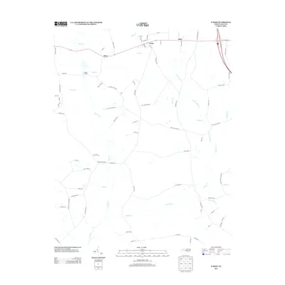
2013 Map of Turkey
USGS Topo · Published 2013About this map
The town of Turkey and the small settlement of Elliott anchor this coastal plain landscape in Duplin County, defined by a complex network of slow-moving blackwater streams and historical mill sites. The drainage pattern is dominated by Six Runs Cr and its many tributaries, including Carltons Mill Run and Sikes Mill Run, indicating a legacy of water-powered industry that once shaped the local economy.
Find a feature on this map
79 named features on this map. Tap any name to fly to it.
Don’t see what you’re looking for? This feature index may not catch every label — zoom into the map to look around manually.
Map Details
Editions of this 2013 Turkey Map
This is the sole edition of this map. No revisions or reprints were ever made.
Other maps of this area

1909 · Coharie
USGS Topo · 1:62,500

1953 · Florence
USGS Topo · 1:250,000

1953 · Raleigh
USGS Topo · 1:250,000

1954 · Florence
USGS Topo · 1:250,000

1954 · Raleigh
USGS Topo · 1:250,000

1959 · Garland
USGS Topo · 1:62,500

1962 · Rose Hill
USGS Topo · 1:62,500

1975 · Faison
USGS Topo · 1:24,000
1977 · Warsaw North
USGS Topo · 1:24,000

1982 · Elizabethtown
USGS Topo · 1:100,000