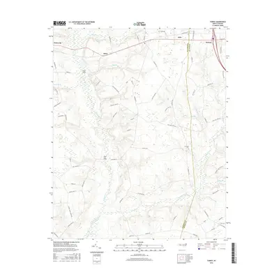
2016 Map of Turkey
USGS Topo · Published 2016About this map
Six Runs Creek and its many tributaries, including Turkey Cr and Mill Run, carve a dense network through this coastal plain landscape. The terrain is defined by these slow-moving watercourses and the bridges that connect rural communities, such as Kirbys Bridge and Reeds Ford Bridge. The eastern edge of the map features the established town of Warsaw, where the street grid transitions into the sprawling agricultural lands of the surrounding countryside. Smaller settlements like Elliott and Moltonville serve as local hubs along the road network. This survey captures the region's enduring reliance on the land, evidenced by the numerous named mill runs like Carltons Mill Run and Sikes Mill Run, which point to a long history of water-powered industry. The New Hope Cem stands as a quiet record of the families who have inhabited this part of Sampson and Duplin Counties for generations.
Find a feature on this map
72 named features on this map. Tap any name to fly to it.
Don’t see what you’re looking for? This feature index may not catch every label — zoom into the map to look around manually.
Map Details
Editions of this 2016 Turkey Map
This is the sole edition of this map. No revisions or reprints were ever made.
Other maps of this area

1909 · Coharie
USGS Topo · 1:62,500

1953 · Florence
USGS Topo · 1:250,000

1953 · Raleigh
USGS Topo · 1:250,000

1954 · Florence
USGS Topo · 1:250,000

1954 · Raleigh
USGS Topo · 1:250,000

1959 · Garland
USGS Topo · 1:62,500

1962 · Rose Hill
USGS Topo · 1:62,500

1975 · Faison
USGS Topo · 1:24,000
1977 · Warsaw North
USGS Topo · 1:24,000

1982 · Elizabethtown
USGS Topo · 1:100,000