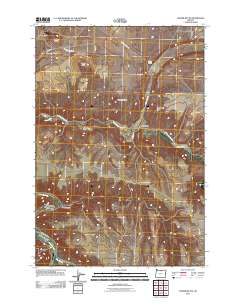
2011 Map of Turner Butte
USGS Topo · Published 2011About this map
Rock Creek flows through the center of this Sherman County landscape, where the high desert terrain is punctuated by distinctive volcanic remnants and deep-cut drainages. The John Day River winds through the southwestern corner, joined by Hay Creek near the mouth of Scott Canyon. This 2011 survey reveals a remote ranching and agricultural region defined by expansive open plateaus and isolated peaks like Turner Butte, Diamond Butte, and Butcher Butte.
Find a feature on this map
17 named features on this map. Tap any name to fly to it.
Don’t see what you’re looking for? This feature index may not catch every label — zoom into the map to look around manually.
Map Details
Editions of this 2011 Turner Butte Map
This is the sole edition of this map. No revisions or reprints were ever made.
Other maps of this area

1916 · Arlington
USGS Topo · 1:125,000

1916 · Condon
USGS Topo · 1:125,000

1953 · The Dalles
USGS Topo · 1:250,000

1956 · The Dalles
USGS Topo · 1:250,000

1957 · The Dalles
USGS Topo · 1:250,000

1964 · Turner Butte
USGS Topo · 1:24,000

1964 · Shutler Flat
USGS Topo · 1:24,000

1964 · Mc Donald
USGS Topo · 1:24,000

1970 · Devils Backbone
USGS Topo · 1:24,000
1970 · Mikkalo
USGS Topo · 1:24,000