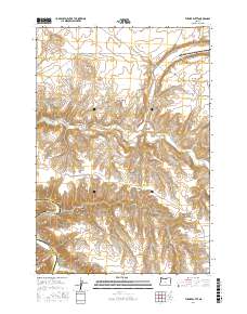
2017 Map of Turner Butte
USGS Topo · Published 2017About this map
Turner Butte and Butcher Butte rise above the high plateau landscape of Sherman County, where the transition between flat rangelands and deep-cut drainage systems defines the local geography. The settlement of Rock Creek is positioned near the creek of the same name, while the southwestern corner is dominated by the winding course of the John Day River, which forms a natural boundary with Gilliam County. This 2017 survey reveals a network of rural roads such as Barnett Rd and Morrison Rd that provide access to remote landmarks like Diamond Butte and the broad expanse of Shutler Flat. The terrain is marked by significant elevation changes, particularly around Scott Canyon and Alkali Canyon, illustrating the erosive forces that have shaped this portion of the Columbia Plateau over millennia. The map serves as a contemporary record of land use in a region where water sources like Cedar Spring remain vital features in an otherwise arid environment.
Find a feature on this map
22 named features on this map. Tap any name to fly to it.
Don’t see what you’re looking for? This feature index may not catch every label — zoom into the map to look around manually.
Map Details
Editions of this 2017 Turner Butte Map
This is the sole edition of this map. No revisions or reprints were ever made.
Other maps of this area

1916 · Arlington
USGS Topo · 1:125,000

1916 · Condon
USGS Topo · 1:125,000

1953 · The Dalles
USGS Topo · 1:250,000

1956 · The Dalles
USGS Topo · 1:250,000

1957 · The Dalles
USGS Topo · 1:250,000

1964 · Turner Butte
USGS Topo · 1:24,000

1964 · Shutler Flat
USGS Topo · 1:24,000

1964 · Mc Donald
USGS Topo · 1:24,000

1970 · Devils Backbone
USGS Topo · 1:24,000
1970 · Mikkalo
USGS Topo · 1:24,000