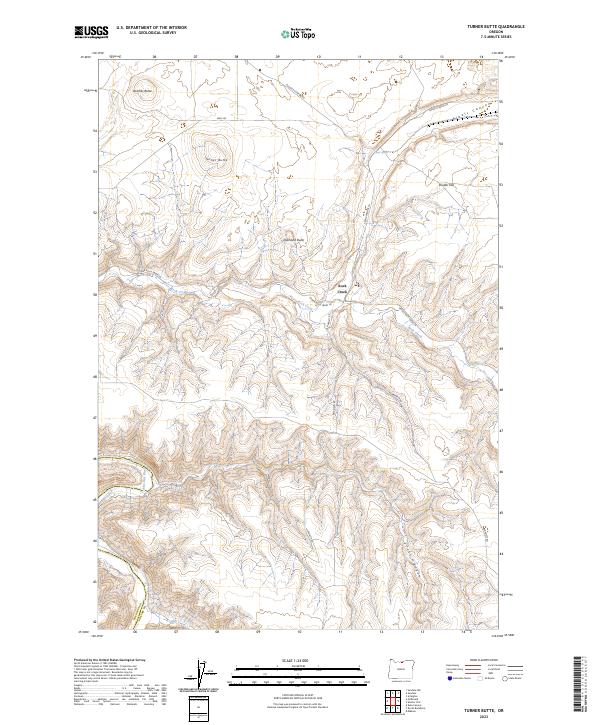
2023 Map of Turner Butte
USGS Topo · Published 2023About this map
Turner Butte and Butcher Butte dominate the landscape in this section of the Oregon high country, where the winding course of the John Day River carves through the southwestern corner of the quadrangle. The area is defined by its deep drainage systems, including the protected waters of the John Day Wild and Scenic River and the branching reaches of Rock Creek. These waterways have historically dictated the placement of roads like Lower Rock Creek Ln and Barnett Rd as they follow the natural contours of the breaks.
Find a feature on this map
23 named features on this map. Tap any name to fly to it.
Don’t see what you’re looking for? This feature index may not catch every label — zoom into the map to look around manually.
Map Details
Editions of this 2023 Turner Butte Map
This is the sole edition of this map. No revisions or reprints were ever made.
Other maps of this area

1916 · Arlington
USGS Topo · 1:125,000

1916 · Condon
USGS Topo · 1:125,000

1953 · The Dalles
USGS Topo · 1:250,000

1956 · The Dalles
USGS Topo · 1:250,000

1957 · The Dalles
USGS Topo · 1:250,000

1964 · Turner Butte
USGS Topo · 1:24,000

1964 · Shutler Flat
USGS Topo · 1:24,000

1964 · Mc Donald
USGS Topo · 1:24,000

1970 · Devils Backbone
USGS Topo · 1:24,000
1970 · Mikkalo
USGS Topo · 1:24,000