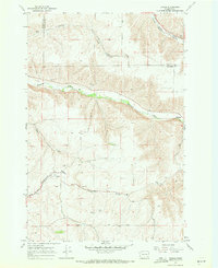
1967 Map of Turner
USGS Topo · Published 1971About this map
Tucannon River winds through the northern portion of this Columbia County landscape, carving a deep valley that contrasts with the surrounding agricultural tablelands. The settlement at Turner serves as a focal point in the southwest, situated where Whetstone Creek and Willow Creek drainage patterns converge. This area shows a transportation network transitioning from the high-capacity Union Pacific railroad line near the creek beds to primitive infrastructure like the Low Road and various Jeep Trails that scale the higher elevations. Genealogists and local historians will find the locations of Turner Cem and Covello Cem particularly significant, as they mark the centers of early community life. The map also documents the transition from Garfield to Columbia County, following the Pataha Creek Valley in the northeast corner near Marengo.
Find a feature on this map
18 named features on this map. Tap any name to fly to it.
Don’t see what you’re looking for? This feature index may not catch every label — zoom into the map to look around manually.
Map Details
Editions of this 1967 Turner Map
2 editions found
Other maps of this area

1937 · Pomeroy
USGS Topo · 1:96,000

1942 · Pomeroy
USGS Topo · 1:125,000

1950 · Penawawa
USGS Topo · 1:62,500

1950 · Hay
USGS Topo · 1:62,500

1952 · Hay
USGS Topo · 1:62,500

1955 · Pullman
USGS Topo · 1:250,000

1958 · Pullman
USGS Topo · 1:250,000

1967 · Hopkins Ridge
USGS Topo · 1:24,000

1967 · Cahill Mtn
USGS Topo · 1:24,000

1967 · Turner
USGS Topo · 1:24,000