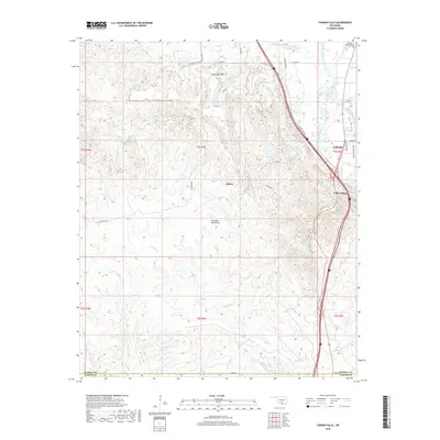
2018 Map of Turner Falls
USGS Topo · Published 2018About this map
The Arbuckle Mountains dominate this landscape, where the Washita River carves through the terrain of southern Oklahoma. This 2018 survey documents a region defined by its hydrography and industrial access, notably the Dolese Plant Rd serving local extraction sites near Horseshoe Mtn. Settlements like Jollyville and Cedar Village occupy the eastern corridor, positioned between the river and the primary north-south transportation routes. Water is central to the area's character, from the well-known Bridal Veil Falls to smaller features like Horseshoe Spring and Honey Cr. Genealogists will find the Green Hill Cem located in the northeast corner, providing a specific anchor for family research. The map also delineates the Murray and Carter county line along the southern boundary, intersecting with several drainages including Henry House Cr and Falls Cr.
Find a feature on this map
37 named features on this map. Tap any name to fly to it.
Don’t see what you’re looking for? This feature index may not catch every label — zoom into the map to look around manually.
Map Details
Editions of this 2018 Turner Falls Map
This is the sole edition of this map. No revisions or reprints were ever made.
Other maps of this area

1898 · Pauls Valley
USGS Topo · 1:125,000

1901 · Ardmore
USGS Topo · 1:125,000

1902 · Pauls Valley
USGS Topo · 1:125,000

1918 · Ardmore
USGS Topo · 1:125,000

1957 · Ardmore
USGS Topo · 1:250,000

1963 · Ardmore
USGS Topo · 1:250,000
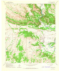
1964 · Gene Autry
USGS Topo · 1:24,000

1964 · Springer
USGS Topo · 1:24,000

1964 · Turner Falls
USGS Topo · 1:24,000

1965 · Davis
USGS Topo · 1:24,000