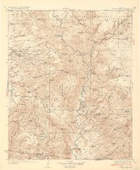
1933 Map of Turret Peak
USGS Topo · Published 1933About this map
Mining operations and remote ranching outposts define this 1933 survey of the Central Arizona landscape. The Verde River cuts a deep path through the center of the sheet, flanked by the high plateaus of Tule Mesa and Polles Mesa. The presence of the United Arizona Mine, Copper Queen Mine, and Rosalie Mine indicates a period of active mineral prospecting and extraction along the rugged western slopes.
Find a feature on this map
160 named features on this map. Tap any name to fly to it.
Don’t see what you’re looking for? This feature index may not catch every label — zoom into the map to look around manually.
Map Details
Editions of this 1933 Turret Peak Map
3 editions found

Other maps of this area

1887 · Verde
USGS Topo · 1:250,000

1887 · Prescott
USGS Topo · 1:250,000

1892 · Verde
USGS Topo · 1:250,000

1892 · Prescott
USGS Topo · 1:250,000

1903 · Bradshaw Mountains
USGS Topo · 1:125,000

1905 · Jerome
USGS Topo · 1:125,000

1907 · Roosevelt
USGS Topo · 1:125,000

1909 · Four Peaks
USGS Topo · 1:125,000

1912 · Roosevelt
USGS Topo · 1:125,000

1923 · Camp Verde
USGS Topo · 1:125,000