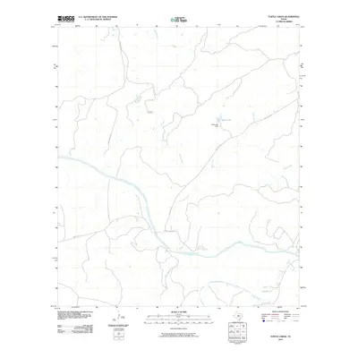
2010 Map of Turtle Creek
USGS Topo · Published 2010About this map
The Llano River carves a distinctive path through this central Texas landscape, where the confluence with the James River and several tributary streams define the local topography. This 2010 survey of the area near Mason illustrates a network of rural routes, such as Bear Springs Rd and Ranch Rd 1871, which connect the isolated ranchlands and water sources.
Find a feature on this map
13 named features on this map. Tap any name to fly to it.
Don’t see what you’re looking for? This feature index may not catch every label — zoom into the map to look around manually.
Map Details
Editions of this 2010 Turtle Creek Map
This is the sole edition of this map. No revisions or reprints were ever made.
Other maps of this area

1887 · Mason
USGS Topo · 1:125,000

1894 · Mason
USGS Topo · 1:125,000

1954 · Llano
USGS Topo · 1:250,000

1955 · Llano
USGS Topo · 1:250,000

1956 · Llano
USGS Topo · 1:250,000

1962 · Purdy Hill
USGS Topo · 1:24,000
1967 · Panther Creek
USGS Topo · 1:24,000
1967 · Mason
USGS Topo · 1:24,000
1967 · Monument Mountain SE
USGS Topo · 1:24,000

1968 · Monument Mountain
USGS Topo · 1:24,000