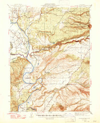
1947 Map of Tuscan Buttes
USGS Topo · Published 1947About this map
The Sacramento River carves through this northern California landscape, serving as a corridor for historical settlement and early regional infrastructure. Traces of early frontier history are prominent, including the Site of Ft Reading and the nearby Ruins of Reading Adobe, marking the legacy of Major Pierson B. Reading. Large landholdings like Rancho Buenaventura and Rancho Rio Alto illustrate the transitional era between Mexican land grants and mid-century ranching.
Find a feature on this map
72 named features on this map. Tap any name to fly to it.
Don’t see what you’re looking for? This feature index may not catch every label — zoom into the map to look around manually.
Map Details
Editions of this 1947 Tuscan Buttes Map
2 editions found

Other maps of this area

1886 · Lassen Peak
USGS Topo · 1:250,000

1890 · Red Bluff
USGS Topo · 1:250,000

1892 · Lassen Peak
USGS Topo · 1:250,000

1894 · Lassen Peak
USGS Topo · 1:250,000

1894 · Red Bluff
USGS Topo · 1:250,000

1901 · Redding
USGS Topo · 1:125,000

1905 · Tehama
USGS Topo · 1:62,500

1935 · Burney
USGS Topo · 1:96,000

1935 · Paynes Creek
USGS Topo · 1:96,000

1939 · Burney
USGS Topo · 1:125,000