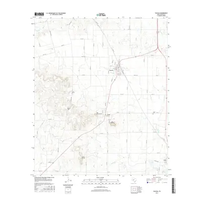
2016 Map of Tuscola
USGS Topo · Published 2016About this map
The town of Tuscola serves as a central hub in this corner of Taylor County, where the landscape transitions into the distinctive mesas and passes of the Callahan Divide. Small settlements like Ovalo and Lawn anchor the southern reaches, connected by a network of ranch roads that navigate the complex topography. Family history is etched into the terrain at Lemons Gap Cem and McBee Cem, providing critical landmarks for genealogists researching early inhabitants of these prairie communities.
Find a feature on this map
73 named features on this map. Tap any name to fly to it.
Don’t see what you’re looking for? This feature index may not catch every label — zoom into the map to look around manually.
Map Details
Editions of this 2016 Tuscola Map
This is the sole edition of this map. No revisions or reprints were ever made.
Other maps of this area

1890 · Abilene
USGS Topo · 1:125,000

1892 · Abilene
USGS Topo · 1:125,000

1954 · Abilene
USGS Topo · 1:250,000

1957 · Kirby Lake
USGS Topo · 1:62,500

1957 · Buffalo Gap
USGS Topo · 1:62,500

1958 · Abilene
USGS Topo · 1:250,000

1967 · Tuscola
USGS Topo · 1:24,000
1967 · Lake Abilene
USGS Topo · 1:24,000
1967 · Lawn
USGS Topo · 1:24,000
1967 · Goldsboro
USGS Topo · 1:24,000