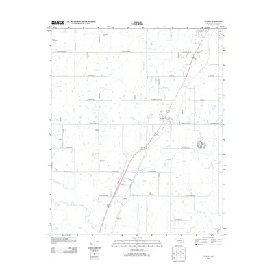
2013 Map of Tushka
USGS Topo · Published 2013About this map
Tushka anchors this part of Atoka County, serving as a primary settlement along the major north-south transit corridor. The landscape is defined by the winding course of Clear Boggy Cr and its tributaries, including Big Br and Fronterhouse Cr. This survey captures the rural character of the region, where family and community heritage is preserved in numerous burial grounds like Wards Chapel Cem and Plainview Cem. The placement of Taloah and Cook further south illustrates the historic settlement pattern that followed the railroad and water sources through the plains of southern Oklahoma.
Find a feature on this map
75 named features on this map. Tap any name to fly to it.
Don’t see what you’re looking for? This feature index may not catch every label — zoom into the map to look around manually.
Map Details
Editions of this 2013 Tushka Map
This is the sole edition of this map. No revisions or reprints were ever made.
Other maps of this area

1899 · Atoka
USGS Topo · 1:125,000

1900 · Atoka
USGS Topo · 1:125,000

1956 · Stringtown
USGS Topo · 1:24,000

1957 · Lehigh
USGS Topo · 1:24,000

1957 · Bruno
USGS Topo · 1:24,000

1957 · Ardmore
USGS Topo · 1:250,000

1963 · Ardmore
USGS Topo · 1:250,000
1969 · Boggy Depot
USGS Topo · 1:24,000

1969 · Caddo North
USGS Topo · 1:24,000
1969 · Tushka
USGS Topo · 1:24,000