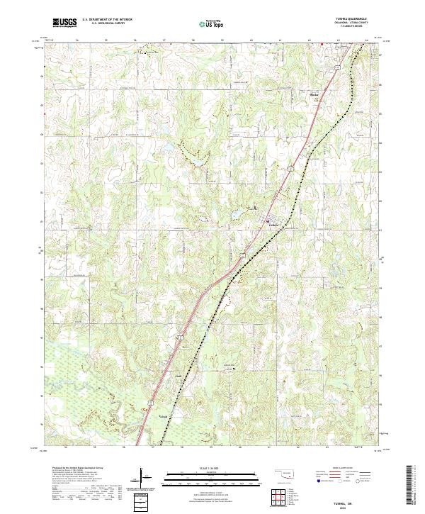
2022 Map of Tushka
USGS Topo · Published 2022About this map
Atoka and Tushka anchor this region of Oklahoma, where the landscape is defined by the winding paths of Clear Boggy Creek and its various tributaries. The map shows a transition from the larger settlement of Atoka in the northeast corner down through several smaller communities and family-named landmarks. The spatial arrangement of Plainview Cem, Tushka Cem, and High Hill Cem provides important reference points for genealogical research, marking the long-established burial grounds that serve these rural communities. Movement through the area is guided by the established road network, with routes like N Jefferson St and Mockingbird Ln connecting the residential centers to more remote southern settlements like Cook and Taloah. Water features such as Big Slough and Lain Lake indicate the low-lying, well-watered nature of the terrain west of the main settlements.
Find a feature on this map
67 named features on this map. Tap any name to fly to it.
Don’t see what you’re looking for? This feature index may not catch every label — zoom into the map to look around manually.
Map Details
Editions of this 2022 Tushka Map
This is the sole edition of this map. No revisions or reprints were ever made.
Other maps of this area

1899 · Atoka
USGS Topo · 1:125,000

1900 · Atoka
USGS Topo · 1:125,000

1956 · Stringtown
USGS Topo · 1:24,000

1957 · Lehigh
USGS Topo · 1:24,000

1957 · Bruno
USGS Topo · 1:24,000

1957 · Ardmore
USGS Topo · 1:250,000

1963 · Ardmore
USGS Topo · 1:250,000
1969 · Boggy Depot
USGS Topo · 1:24,000

1969 · Caddo North
USGS Topo · 1:24,000
1969 · Tushka
USGS Topo · 1:24,000