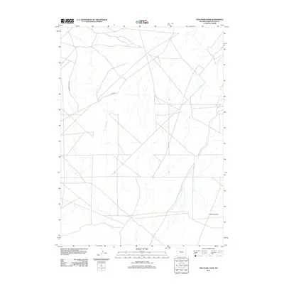
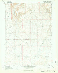
2012 Map of Twelvemile Sink
USGS Topo · Published 2012About this map
Twelvemile Sink characterizes this high-desert region of Sweetwater County, where the landscape is defined by its subtle drainage patterns and sparse network of transport routes. The 2012 survey illustrates the remote character of the basin, dominated by extensive drainage systems that feed into the central sink. Human presence is evidenced primarily by two significant unpaved corridors: Monument Butte Rd and 18 Mile Rd, which cross the terrain to connect distant ranching or resource areas. The lack of traditional settlements or structures emphasizes the open, undeveloped nature of the Wyoming interior during the early 21st century, making it a critical record for those studying the intersection of geology and historic public land use.
Find a feature on this map
3 named features on this map. Tap any name to fly to it.
Don’t see what you’re looking for? This feature index may not catch every label — zoom into the map to look around manually.
Map Details
Editions of this 2012 Twelvemile Sink Map
This is the sole edition of this map. No revisions or reprints were ever made.
Other maps of this area

1954 · Rock Springs
USGS Topo · 1:250,000

1955 · Lander
USGS Topo · 1:250,000

1958 · Lander
USGS Topo · 1:250,000

1958 · Rock Springs
USGS Topo · 1:250,000

1961 · Lander
USGS Topo · 1:250,000

1962 · Rock Springs
USGS Topo · 1:250,000
1963 · Gasson Bridge
USGS Topo · 1:24,000
1963 · Mc Cullen Bluff
USGS Topo · 1:24,000
1963 · Thoman School
USGS Topo · 1:24,000
1968 · Twelvemile Sink
USGS Topo · 1:24,000