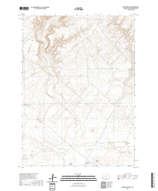
2021 Map of Twelvemile Sink
USGS Topo · Published 2021About this map
Twelvemile Sink occupies a unique depressions in this high-desert landscape of Sweetwater County, where the topography is defined by significant canyons and a sparse network of access roads. The terrain is marked by the presence of Buckhorn Canyon and Eighteenmile Canyon, which cut through the southwestern portions of the quadrangle. These drainage patterns illustrate the region's arid geomorphology, characterized by deep incisions that funnel toward the sink. Human movement through this remote territory is traced via Eighteen Mile Rd and Monument Butte Rd, which navigate the high ground between the canyons. The map provides a detailed survey of the Public Land Survey System grid, including corners for t24n r109w and t24n r110w, showing how this rugged Wyoming landscape was systematically partitioned for grazing and mineral management in the early twenty-first century.
Find a feature on this map
12 named features on this map. Tap any name to fly to it.
Don’t see what you’re looking for? This feature index may not catch every label — zoom into the map to look around manually.
Map Details
Editions of this 2021 Twelvemile Sink Map
This is the sole edition of this map. No revisions or reprints were ever made.
Other maps of this area

1954 · Rock Springs
USGS Topo · 1:250,000

1955 · Lander
USGS Topo · 1:250,000

1958 · Lander
USGS Topo · 1:250,000

1958 · Rock Springs
USGS Topo · 1:250,000

1961 · Lander
USGS Topo · 1:250,000

1962 · Rock Springs
USGS Topo · 1:250,000

1963 · Gasson Bridge
USGS Topo · 1:24,000
1963 · Mc Cullen Bluff
USGS Topo · 1:24,000
1963 · Thoman School
USGS Topo · 1:24,000
1968 · Twelvemile Sink
USGS Topo · 1:24,000